Garmin Bulgaria OFRM Geotrade City&Topo - 2013 Q1
Sat Feb 09, 2013 1:59 pm
Garmin Bulgaria OFRM Geotrade City&Topo - 2013 Q1
Requirements: for all Garmin Devices
Overview: National road network updates
Version 2013 Q1 includes new roundabouts in Pernik and Kostindrod. Photorealistic junction views have been added for the newest part of Trakia motorway between Stara Zagora and Zimnitsa, and for both new multi-level road junctions in Sofia.
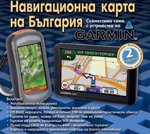
More Info:
Download Instructions:
[Please Register or Login to download file] or [Please Register or Login to download file]
all in ML
FID 1204
password: ozboss18
inside:
unlocked image of City Map
unlocked image of Topo map
JCV file
Hoster
netload.in
share-online.biz
Requirements: for all Garmin Devices
Overview: National road network updates
Version 2013 Q1 includes new roundabouts in Pernik and Kostindrod. Photorealistic junction views have been added for the newest part of Trakia motorway between Stara Zagora and Zimnitsa, and for both new multi-level road junctions in Sofia.

More Info:
- Code:
http://karta.bg//index.php?language_id=2
Download Instructions:
[Please Register or Login to download file]
 or [Please Register or Login to download file]
all in ML
FID 1204
password: ozboss18
inside:
unlocked image of City Map
unlocked image of Topo map
JCV file
Hoster
netload.in
share-online.biz
Sat Feb 09, 2013 3:18 pm
Updates on the national road network
In Q1 2013 version added new circular in Pernik Municipality. Increased number of photorealistic views of road branches have been added such as a section of highway "Trakia" from Stara Zagora to Zimnitsa, and the new junctions in Sofia.
*
Advances in capital
The new version added the junction of two levels in between the Television Tower Blvd Dragan Tsankov "and" Peyo Yavorov 'junction between the two levels Boulevard Acad Ivan Evstatiev Geshov's street 'St George Sofia 'and the junction between the Boulevard of St. Kliment Ohridski "and the southern arc of the ring road. The card contains a newly built promenade for 'Andrei Sakharov' that connects Boulevard 'Malinov's Station' Mladost 3 '. Added data for Blue and Green Zone and the corresponding sub. New streets are reflected in one direction and blocks in the new residential complexes.
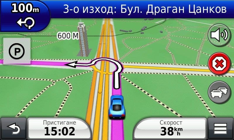
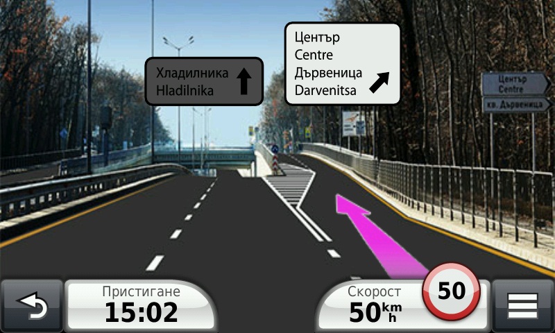
Extended coverage in urban areas
Added missing street names, house numbers and apartment buildings in some districts of Vidin, Razgrad, Ruse, Sliven, Shumen and Yambol. Q1 2013 version includes many new sites of public interest.
**
For off-road enthusiasts and Tourism
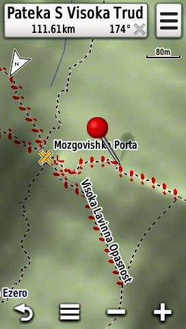
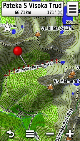
Off-road enthusiasts can enjoy the new 264 km offroad categorized areas and 87 miles of hiking and bike paths, and precise data previously uncategorized sites in previous versions of the map.
original mapset locked without 3D
jcv/izo/map
unl. img one file+jcv
home made mapsource version
search function not working
In Q1 2013 version added new circular in Pernik Municipality. Increased number of photorealistic views of road branches have been added such as a section of highway "Trakia" from Stara Zagora to Zimnitsa, and the new junctions in Sofia.
*
Advances in capital
The new version added the junction of two levels in between the Television Tower Blvd Dragan Tsankov "and" Peyo Yavorov 'junction between the two levels Boulevard Acad Ivan Evstatiev Geshov's street 'St George Sofia 'and the junction between the Boulevard of St. Kliment Ohridski "and the southern arc of the ring road. The card contains a newly built promenade for 'Andrei Sakharov' that connects Boulevard 'Malinov's Station' Mladost 3 '. Added data for Blue and Green Zone and the corresponding sub. New streets are reflected in one direction and blocks in the new residential complexes.


Extended coverage in urban areas
Added missing street names, house numbers and apartment buildings in some districts of Vidin, Razgrad, Ruse, Sliven, Shumen and Yambol. Q1 2013 version includes many new sites of public interest.
**
For off-road enthusiasts and Tourism
Off-road enthusiasts can enjoy the new 264 km offroad categorized areas and 87 miles of hiking and bike paths, and precise data previously uncategorized sites in previous versions of the map.


original mapset locked without 3D
jcv/izo/map
- Code:
OFRM Geotrade CITY CYR.rar
[url=http://www76.zippyshare.com/v/5906553/file.html]Zippyshare.com - OFRM Geotrade CITY CYR.rar[/url]
OFRM Geotrade TOPO LT LAT.rar
[url=http://www8.zippyshare.com/v/35302353/file.html]Zippyshare.com - OFRM Geotrade TOPO LT LAT.rar[/url]
OFRM Geotrade CITY ML.rar
[url=http://www10.zippyshare.com/v/37508372/file.html]Zippyshare.com - OFRM Geotrade CITY ML.rar[/url]
OFRM Geotrade CITY LAT.rar
[url=http://www59.zippyshare.com/v/8108915/file.html]Zippyshare.com - OFRM Geotrade CITY LAT.rar[/url]
OFRM Geotrade TOPO LT CYR.rar
[url=http://www63.zippyshare.com/v/83404828/file.html]Zippyshare.com - OFRM Geotrade TOPO LT CYR.rar[/url]
OFRM Geotrade TOPO LAT.rar
[url=http://www65.zippyshare.com/v/4887583/file.html]Zippyshare.com - OFRM Geotrade TOPO LAT.rar[/url]
OFRM Geotrade TOPO ML.rar
[url=http://www62.zippyshare.com/v/54142531/file.html]Zippyshare.com - OFRM Geotrade TOPO ML.rar[/url]
OFRM Geotrade TOPO CYR.rar
[url=http://www54.zippyshare.com/v/28363999/file.html]Zippyshare.com - OFRM Geotrade TOPO CYR.rar[/url]
unl. img one file+jcv
- Code:
OFRM Geotrade LAT SET.rar
[url]https://anonfiles.com/file/6bb5aa89883f72c38c3f34655afcb36e[/url]

OFRM Geotrade CYR SET
[url]https://anonfiles.com/file/18ed63c22d0809be7b523cb413cc9eeb[/url]

OFRM Geotrade ML SET.rar
[url]https://anonfiles.com/file/5ff81048426c340dfdf448673a6a5824[/url]
home made mapsource version
search function not working
- Code:
OFRM Geotrade TOPO CYR MS.rar
[url] https://anonfiles.com/file/64426115d2bd7107ef7f8f84ebea4cd5[/url]

OFRM Geotrade TOPO LAT MS.rar
[url]https://anonfiles.com/file/77b7887730ea7bbbdc8ca31fffb715d6[/url]