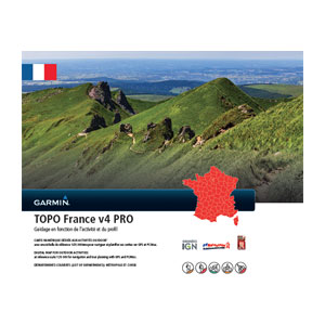
TOPO France v4.01 PRO
Wed Jun 24, 2015 5:34 am
TOPO France v4.01 PRO

Prepare for your next great outdoor adventure in France with this highly detailed topographic mapping product. With fully routable maps and Garmin ActiveRouting¹, it contains versatile route planning for walking and cycling.
FID: 3080
Image:
SQL: (010-D1198-01.db)
Image: SQL FIX (010-D1198-01)

Original images
[Please Register or Login to download file]


[Please Register or Login to download file]


[Please Register or Login to download file]


[Please Register or Login to download file]


Prepare for your next great outdoor adventure in France with this highly detailed topographic mapping product. With fully routable maps and Garmin ActiveRouting¹, it contains versatile route planning for walking and cycling.
- Integrates topographic vector map data from IGN at a scale of 1:25,000 on compatible devices
- Displays content from FFC (mountain bike trails) and GR (hiking trails)
- Plans customized activity routes using ActiveRouting¹, showing routable roads and paths for walking and cycling tours
- Offers thousands of different destination choices with searchable addresses, geographic names and business points of interest
- Provides 3-D view and elevation shading on compatible devices so you can estimate terrain difficulty
FID: 3080
Image:
Locked:
[Please Register or Login to download file]
UnLocked:
[Please Register or Login to download file]
- Code:
File:      G:\Garmin\gmapsupp.img, length 3407872000
Header:      10.06.2015 13:54:21, DSKIMG, XOR 00, V 4.01, Ms 0, 006-D1270-02
Mapset:      TOPO France v4 PRO

Data MPS
 V: Solaro, Favalello, Saliceto, Querigut, Felines-Ter (1)
 F: PID 1, FID 3080, TOPO France v4 PRO
SQL: (010-D1198-01.db)
Image: SQL FIX (010-D1198-01)
UnLocked:
[Please Register or Login to download file]
- Code:
File:      G:\Garmin\gmapsupp.img, length 3407872000
Header:      10.06.2015 13:54:21, DSKIMG, XOR 00, V 4.01, Ms 0, 010-D1198-01
Mapset:      TOPO France v4 PRO

Data MPS
 V: Solaro, Favalello, Saliceto, Querigut, Felines-Ter (1)
 F: PID 1, FID 3080, TOPO France v4 PRO
- Code:
https://buy.garmin.com/en-US/US/prod520093.html

Original images
[Please Register or Login to download file]

- Code:
https://buy.garmin.com/en-US/US/prod520089.html

[Please Register or Login to download file]

- Code:
https://buy.garmin.com/en-US/US/prod520090.html

[Please Register or Login to download file]

- Code:
https://buy.garmin.com/en-US/US/prod520091.html

[Please Register or Login to download file]

- Code:
https://buy.garmin.com/en-US/US/prod520092.html

Last edited by huntsman on Mon Mar 14, 2016 12:29 pm, edited 3 times in total.
Re: TOPO France v4.01 PRO
Thu Jun 25, 2015 1:44 pm
Download Instructions:
Inside:
unlocked image
sql folder
hoster
filefactory.com
share-online.biz
- Hidden Content
- This board requires you to be registered and logged-in to view hidden content.
Inside:
unlocked image
sql folder
hoster
filefactory.com
share-online.biz
Re: TOPO France v4.01 PRO
Fri Jun 26, 2015 5:20 am
unl.img+sql
- Hidden Content
- This board requires you to be registered and logged-in to view hidden content.
- Hidden Content
- This board requires you to be registered and logged-in to view hidden content.
Re: TOPO France v4.01 PRO
Thu Sep 03, 2015 11:25 am
Hello,
I just download the rar file Ozboss and Bam Bam .
when I want to burn the image of .img file,
I get an error message that the image file is invalid .
why thank you for your help.
I just download the rar file Ozboss and Bam Bam .
when I want to burn the image of .img file,
I get an error message that the image file is invalid .
why thank you for your help.
Re: TOPO France v4.01 PRO
Sun Oct 04, 2015 8:35 am
merci de ta contribution
Re: TOPO France v4.01 PRO
Sat Jan 23, 2016 8:56 am
Bonjour A tous,
Je viens de télécharger les fichiers.
La décompression se passe sans probleme mais je n'arrive pas a utiliser l'image.
Quelqu'un pour m'aider SVP.
Je viens de télécharger les fichiers.
La décompression se passe sans probleme mais je n'arrive pas a utiliser l'image.
Quelqu'un pour m'aider SVP.
Re: TOPO France v4.01 PRO
Sat Jan 23, 2016 9:06 am
thewinner wrote:Bonjour A tous,
Je viens de télécharger les fichiers.
La décompression se passe sans probleme mais je n'arrive pas a utiliser l'image.
Quelqu'un pour m'aider SVP.
C est simple il faut seulement copier le fichier a \Garmin ou la ou se trouve votre fichier (.img) quelle est votre machine?
Re: TOPO France v4.01 PRO
Sat Jan 23, 2016 9:25 am
Je possede un garmin edge 810
Re: TOPO France v4.01 PRO
Sat Jan 23, 2016 9:39 am
thewinner wrote:Je possede un garmin edge 810
Excusez mois je n ai pas une bonne connaisance de edge810 mais il faut exister quelquepart un directory \Garmin ou \map la il faut s installer le fichier avec le nom gmapsupp.img
I y a une pettite possibilite que votre machine a un firmware (protected) si est apres 2014.
Last edited by kolokythas on Sun Jan 24, 2016 1:26 pm, edited 2 times in total.
Re: TOPO France v4.01 PRO
Sat Jan 23, 2016 9:48 am
Super ça fonctionne.
Merci beaucoup pour votre aide.
Merci beaucoup pour votre aide.
Re: TOPO France v4.01 PRO
Tue Feb 23, 2016 12:53 pm
@ bam-bam
Hidden Content (for members only)
TOPOFrancev4PRO_UN+SQL.part4.rar est incorrect ...?!
Hidden Content (for members only)
TOPOFrancev4PRO_UN+SQL.part4.rar est incorrect ...?!

Re: TOPO France v4.01 PRO
Sat Mar 26, 2016 6:21 am
Que signifie le sigle UN SQL? quelle différence avec le UL ?
merci
merci
Re: TOPO France v4.01 PRO
Tue May 03, 2016 3:30 pm
merci pour les contributions
un peu dur de se retrouver pour un néophyte entre: les images les SQL les LOCK et Unlock....... un petit lexique genre ABC de la topo pour les nuls serait au top
merci encore
un peu dur de se retrouver pour un néophyte entre: les images les SQL les LOCK et Unlock....... un petit lexique genre ABC de la topo pour les nuls serait au top
merci encore
Re: TOPO France v4.01 PRO
Fri May 27, 2016 10:19 am
"II y a une pettite possibilite que votre machine a un firmware (protected) si est apres 2014."
bonjour pouvez vous m'expliqué? que dois ton faire?
merci beaucoup je suis novice
bonjour pouvez vous m'expliqué? que dois ton faire?
merci beaucoup je suis novice
Re: TOPO France v4.01 PRO
Mon Jun 13, 2016 7:12 am
Bonjour
Je viens de télécharger les fichiers Topo france V4
La décompression se passe sans probleme mais je n'arrive pas a utiliser l'image.
Quelqu'un pour m'aider SVP
Le gps utilisé est un Oregon 600 acheté en septembre 2014
Faut-il renommé la carte SD avec un 'nom' spécial?
Merci pour votre aide
Je viens de télécharger les fichiers Topo france V4
La décompression se passe sans probleme mais je n'arrive pas a utiliser l'image.
Quelqu'un pour m'aider SVP
Le gps utilisé est un Oregon 600 acheté en septembre 2014
Faut-il renommé la carte SD avec un 'nom' spécial?
Merci pour votre aide