It is currently Tue Feb 18, 2025 10:40 pm

News News of New Maps

Site map of New Maps » Forum : New Maps

BlueChart g2 Vision - VUS513L - Jacksonville - Bahamas 2014.5 (16.00)

Image

unl.img

This board requires you to be registered and logged-in to view hidden content.


"new" Garmin City Navigator NT 2015.40 is a fake

I have tested all NT 2015.40 found in Internet, including the one from this site, and I can say it is a fake.
Some "smart ass" took the 2014.20 or 2014.30 and changed its header with an Hexadecimal editor to show as 2015.40 on the Garmin Device but:

1) - Garmin promised the first NT to be 2015.40 and to be released in June.
2) - You will get a message on your device saying ...
Read more : "new" Garmin City Navigator NT 2015.40 is a fake | Views : 2308 | Replies : 3


City Navigator Russia NT 2016.10 Navicom

City Navigator Russia NT 2016.10 Navicom

Image

FID 3755

IMG UNL
This board requires you to be registered and logged-in to view hidden content.


3D
This board requires you to be registered and logged-in to view hidden content.


SID
This board requires you to be registered and logged-in to view hidden content.


MS LOCK
This board requires you to be registered and logged-in to view hidden content.
Read more : City Navigator Russia NT 2016.10 Navicom | Views : 3063 | Replies : 0


BlueChart g2 Vision - VPC022R - East Coast Australia Download?

Anyone know where i could download BlueChart g2 Vision - VPC022R - East Coast Australia, want to put it on my garmin gpsmaps431s system.

thanks in advance
Read more : BlueChart g2 Vision - VPC022R - East Coast Australia Download? | Views : 2618 | Replies : 3


City Navigator Southern Africa NT 2016.10

City Navigator Southern Africa NT 2016.10

FID: 3753

Map Source Data:
Locked: Download

UnLocked: Download


3D:
Locked: Download

UnLocked: Download


ADDS: JCV, G2S & SiD


Image:
Locked: Download

UnLocked: Download

Code:
File:      G:/Garmin/gmapsupp.img, length 152080384
Header:      02.04.2015 02:00:00, DSKIMG, XOR 00, V 20.16, Ms 0, D235319AG026
Mapset:      CN Southern Africa NT 2016.10 ALL

Data MPS
 V: CN Southern Africa NT 2016.10 ALL (0)
 U: 00000-00000-00000-00000-00000
 F: PID 1, FID 3753, CN Southern Africa NT 2016.10
...
Read more : City Navigator Southern Africa NT 2016.10 | Views : 5297 | Replies : 5


BlueChart g2 - HAW003R - Indian Subcontinent 2014.5 (16.00)

BlueChart g2 - HAW003R - Indian Subcontinent 2014.5 (16.00)

See your vessel’s precise, on-chart position in relation to navaids, coastal features, anchorages, obstructions, waterways, restricted areas and more with this detailed marine mapping data.
  • Shaded depth contours, coastlines, spot soundings, navaids, port plans, wrecks, obstructions, intertidal zones, restricted areas and IALA symbols.
  • Seamless transitions between zoom levels and more continuity across chart boundaries.
  • Standard 2-D direct overhead or 3-D “over the bow” ...
Read more : BlueChart g2 - HAW003R - Indian Subcontinent 2014.5 (16.00) | Views : 2885 | Replies : 5


Maldives

Hi,

any chance to get the map of the Maldives?
Going on cruise there and would like to follow our way on my Xtrex 30

Thanks

PhP
Read more : Maldives | Views : 1285 | Replies : 0


BlueChart g2 Vision - VEU451S - Ligurian Sea-Corsica & Sardinia 2014.5 (16.00)

BlueChart g2 Vision - VEU451S - Ligurian Sea-Corsica & Sardinia 2014.5 (16.00)

See your vessel’s precise, on-chart position in relation to navaids, coastal features and restricted areas with premium features found in this detailed marine mapping data. Includes all of the features of our BlueChart® g2 product, plus 3-D perspective above and below the waterline, Auto Guidance, high-resolution imagery, and aerial photos of ports, harbors, marinas and landmarks.
  • Shaded depth contours, coastlines, spot soundings, ...


BlueChart g2 Vision - VUS512L - Mid-Atlantic 2014.5 (16.00)

BlueChart g2 Vision - VUS512L - Mid-Atlantic 2014.5 (16.00)

See your vessel’s precise, on-chart position in relation to navaids, coastal features and restricted areas with premium features found in this detailed marine mapping data. Includes all of the features of our BlueChart® g2 product, plus 3-D perspective above and below the waterline, Auto Guidance, high-resolution imagery, and aerial photos of ports, harbors, marinas and landmarks.
  • Shaded depth contours, coastlines, spot soundings, navaids, port plans, ...
Read more : BlueChart g2 Vision - VUS512L - Mid-Atlantic 2014.5 (16.00) | Views : 2430 | Replies : 2


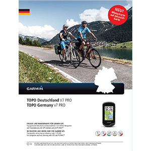
TOPO Germany v7 PRO

TOPO Germany v7 PRO
TOPO Deutschland V7 PRO
Part Number: 010-11288-04 (DVD & MicroSD/SD)

Image

Let us guide you on all of your recreational and outdoor adventures in Germany, from the shores of the North Sea up to the summits of the Alps.

  • Provides accurate topographic maps in reference scale of 1:25,000.
  • offers an enhanced recreational trail network, including detailed hiking trails for touristic regions and long-distance hiking trails (national level).
  • Displays ...
Read more : TOPO Germany v7 PRO | Views : 13446 | Replies : 7


Login  •  Register


Statistics

Total posts 163857 • Total topics 17331 • Total members 672345