 Forum
ForumAERO CZ/EU Basemap 2012 MapSource
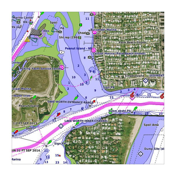
AERO CZ/BASEMAP EUROPE 2012 AIR Map ID: 1364
AERO CZ/BASEMAP EUROPE 2012 TOPO Map ID: 1365
AERO CZ 2012 SPEC Map ID: 1366
https://www.rapidshare.com/files/3228798112/AERO_CZ_Basemap_Europe_2012.rar
http://sharerapid.cz/stahuj/3705030/jenas-aero-cz-basemap-europe-2012.rar

- Contact •
- FAQ •
- Register •
- Login
- View unanswered posts • View active topics
-
 Board index ‹ Site map ‹ News of NaviTotal.com ‹ News of New Maps
It is currently Tue Feb 18, 2025 10:28 pm
 News of New Maps
Site map of New Maps » Forum : New Maps
AERO CZ/EU Basemap 2012 MapSource
Read more : AERO CZ/EU Basemap 2012 MapSource | Views : 2731 | Replies : 0
BlueChart g2 - HUS021R - California-Mexico v2012.5 (v14.00)
BlueChart g2 - HUS021R - California-Mexico v2012.5 (v14.00)
Version: 2012.5
Released: Aug, 2012
Part Numbers: 010-D0554-00 (Download) 010-C0722-20 (microSD/SD) 010-C0722-10 (GarminCard)

See your vessel’s precise, on-chart position in relation to navaids, coastal features, anchorages, obstructions, waterways, restricted areas and more with this detailed marine mapping data. Also includes Safety Shading and Fishing Charts (in compatible units), smooth data transition between zoom levels, harmonious transition across chart borders and reduction of chart discontinuities in coverage ...
Read more : BlueChart g2 - HUS021R - California-Mexico v2012.5 (v14.00) | Views : 3647 | Replies : 7
VUS511L - Boston-Norfolk v2012.1 (v13.51)
VUS511L - Boston-Norfolk v2012.1 (v13.51)
Version: 2012.1
Released: Feb, 2012
Part number: 010-D0499-00
See your vessel’s precise, on-chart position in relation to navaids, coastal features, restricted areas and more with premium features found in this detailed marine mapping data. Includes all of the BlueChart® g2 features, plus 3-D perspective above and below the waterline, Auto Guidance, high-resolution imagery, and aerial photos of ports, harbors, marinas, landmarks and other points of interest.
- Includes realistic navigation ...
Read more : VUS511L - Boston-Norfolk v2012.1 (v13.51) | Views : 1918 | Replies : 2
BlueChart g2 Vision: VPC018R - New Caledonia-Fiji v2012.1 (v
Version: 2012.1
Released: Feb, 2012
See your vessel’s precise, on-chart position in relation to navaids, coastal features, restricted areas and more with premium features found in this detailed marine mapping data. Includes all of the BlueChart® g2 features, plus 3-D perspective above and below the waterline, Auto Guidance, high-resolution imagery, and aerial photos of ports, harbors, marinas, landmarks and other points of interest.
Features
Includes realistic navigation features showing everything from shaded depth contours ...
Read more : BlueChart g2 Vision: VPC018R - New Caledonia-Fiji v2012.1 (v | Views : 2064 | Replies : 0
BlueChart g2 Vision: VPC019R - Polynesia v2011.5 (v13.00)

Garmin info:
- Code: Select all
https://buy.garmin.com/shop/shop.do?pID=9262
Version: 2011.5
Released: Aug, 2011
See your vessel’s precise, on-chart position in relation to navaids, coastal features, restricted areas and more with premium features found in this detailed marine mapping data. Includes all of the BlueChart® g2 features, plus 3-D perspective above and below the waterline, Auto Guidance, high-resolution imagery, and aerial photos of ports, harbors, marinas, landmarks and other points of interest.
Features
Includes realistic navigation features showing everything from ...
Read more : BlueChart g2 Vision: VPC019R - Polynesia v2011.5 (v13.00) | Views : 2370 | Replies : 0
Mapa Gps Pamacol v. 14.2 3D
Colombia Pamacol Garmin routable map v.14
NEW FEATURE ALLOWS LANE ASSIST -- compilation in NT format.
infos
Detailed maps with highways, avenues, streets, residential areas, and industries, plus information on restrictions and different points of navigation, as polygons of rivers, nature reserves and parks, will also display shopping centers, schools, military areas, etc. .
The maps include points of interest with the following classification:
Food and drink (restaurants, fast food, etc.).
Accommodation (hotels, lodges, ...
NEW FEATURE ALLOWS LANE ASSIST -- compilation in NT format.
infos
- Code: Select all
http://www.pamacol.com/mapas_14.php
Detailed maps with highways, avenues, streets, residential areas, and industries, plus information on restrictions and different points of navigation, as polygons of rivers, nature reserves and parks, will also display shopping centers, schools, military areas, etc. .
The maps include points of interest with the following classification:
Food and drink (restaurants, fast food, etc.).
Accommodation (hotels, lodges, ...
Read more : Mapa Gps Pamacol v. 14.2 3D | Views : 2467 | Replies : 1
Taiwan City Navigator NT 2012.20
Taiwan City Navigator NT 2012.20
Nuvi 765:
344.60MB contains Mapsource Taiwan 2012.20, Taiwan Map 2012.20, Taiwan Address Point 2012.20, 3D Buildings 2012.20 and Junction View Standard
Nuvi 760
335.91MB contains Mapsource Taiwan 2012.20, Taiwan Map 2012.20, Taiwan Address Point 2012.20 and Junction View Standard
Nuvi 255W/265
167.45MB
Nuvi 5000
834.47MB contains Mapsource Taiwan 2012.20, Taiwan Map 2012.20, Taiwan Address Point 2012.20 and Junction View Deluxe
Garmin MobileXT
166.62MB contains Mapsource Taiwan ...
Nuvi 765:
344.60MB contains Mapsource Taiwan 2012.20, Taiwan Map 2012.20, Taiwan Address Point 2012.20, 3D Buildings 2012.20 and Junction View Standard
- Code: Select all
http://download.garmin.com/tw/download/MapUpgrade/TWN_CN_2012_20/W1/201220Type01.exe
Nuvi 760
335.91MB contains Mapsource Taiwan 2012.20, Taiwan Map 2012.20, Taiwan Address Point 2012.20 and Junction View Standard
- Code: Select all
http://download.garmin.com/tw/download/MapUpgrade/TWN_CN_2012_20/W1/201220Type02.exe
Nuvi 255W/265
167.45MB
- Code: Select all
http://download.garmin.com/tw/download/MapUpgrade/TWN_CN_2012_20/W1/201220Type03.exe
Nuvi 5000
834.47MB contains Mapsource Taiwan 2012.20, Taiwan Map 2012.20, Taiwan Address Point 2012.20 and Junction View Deluxe
- Code: Select all
http://download.garmin.com/tw/download/MapUpgrade/TWN_CN_2012_20/W1/201220Type04.exe
Garmin MobileXT
166.62MB contains Mapsource Taiwan ...
Read more : Taiwan City Navigator NT 2012.20 | Views : 2480 | Replies : 0
TOPO Germany 2012 Pro - Original
TOPO Germany 2012 Pro
Version: 2012
Released: May, 2012
Part number: 010-D0752-01
Thanks to Heinrich
Let us guide you on all of your recreational and outdoor adventures in Germany, from the shores of the North Sea up to the summits of the Alps. This mapping product comes with new and helpful information, such as single house display and a lot of natural and cultural sites.
- Provides precise topographic maps in reference scale of 1:25.000 ...
Read more : TOPO Germany 2012 Pro - Original | Views : 12487 | Replies : 17
Garmin TransAlpin 2012 Pro
Garmin TransAlpin 2012 Pro
Version: 2012
Released: May, 2012
Part number: 010-11404-01


Always find the right tracks for your alpine adventure in Austria, Germany, Italy, Switzerland, Slovenia and Lichtenstein. The ultimate map for outdoor recreation, Garmin TransAlpine includes hiking/mountain biking trails, mountain peaks and crossings as well as searchable points of interest.
- Shows high quality digital topographic vector map data (1:25.000) in parts of Austria, Italy, Germany, Switzerland and Slovenia
- Includes Digital Elevation ...
Read more : Garmin TransAlpin 2012 Pro | Views : 11361 | Replies : 15
Garmin Azerbaijan routable map
Azerbaijan Map 2012 V.01
Thanks to Caty
- Code: Select all
Header:      30.03.2012 10:48:33, DSKIMG, XOR 00, V 0.00, Ms 1, 000-00000-00
Mapset:      Azerbaijan

Map              length s-f  CP    prio  PID   FID  name
 00001352 MD2      4888  1
 00001352 IDX    687301  2
 I0000548 TYP      3418  1  1252           1  1352
 I08AA000 MPC  12355581  6  1252   24 L    1  1352  Azerbaijan
 MAPSOURC MPS       282  1

Data MPS
 V: Azerbaijan (1)

F: PID 1, FID 1352, Azerbaijan_Map_2012_V01
- Code: Select all
lock
[url]http://www.mirrorcreator.com/files/1I9U7MLF/Azerbaijan_Map_2012_V.01.rar_links[/url]
unlock
[url]http://www.mirrorcreator.com/files/0G418ZVZ/Azerbaijan_Map_2012_V.01U.rar_links[/url]
Thanks to Caty
Read more : Garmin Azerbaijan routable map | Views : 4162 | Replies : 1
Last 10 active topics
Statistics
Total posts 163857 • Total topics 17331 • Total members 672345


