 Forum
Forumlocked img
http://www.fileserve.com/file/wpkpT7n/gmapsupp.img
unlocked img
http://hulkshare.com/9v6dp92si4kk
FID 4944

- Contact •
- FAQ •
- Register •
- Login
- View unanswered posts • View active topics
-
 Board index ‹ Site map ‹ News of NaviTotal.com ‹ News of New Maps
It is currently Tue Feb 18, 2025 10:35 pm
 News of New Maps
Site map of New Maps » Forum : New Maps
Brazil Autoguiagps v3.04 2012
Read more : Brazil Autoguiagps v3.04 2012 | Views : 1944 | Replies : 0
Greek Anavasi 5.39 IMG & MapSource
Greek road/topo map with full coverage of Greece routable but without road index, latest version of Anavasi is 5.39.

The Greek cartographic and map creation software
TopoNavigator5 is a cartographic and automated map compotition software for Greece, developed by AnavDigit. Whilst it maintains the functionality of an open GIS environment, TopoNavigator5 tranfers and displays the AnaDigit geodatabase, including full vector topographic and cartographic information, and provides tools for automatic routing, recording, creating and editing ...
Read more : Greek Anavasi 5.39 IMG & MapSource | Views : 3769 | Replies : 0
Sets GR/CY AutoDrive 2.30T - Anavasi 5.38 - Geomatic Q9.1 &
Sets with the latest versions of Greek & Cyprus maps
GR Greek & Latin Characters:
2in1 Auto Drive 2.30T-Anavasi 5.38
3in1 Auto Drive 2.30T-Anavasi 5.38-Bluechart 2008.5 GR
4in1 Auto Drive 2.30T-Anavasi 5.38-Bluechart 2008.5 GR-NT 2012.30 GR
6in1 Auto Drive 2.30T-Anavasi 5.38-Bluechart 2008.5 GR/CY-Geomatic Q9.1-Recreational 3D 3.01 CY
7in1 Auto Drive 2.30T-Anavasi 5.38-Bluechart 2008.5 GR/CY-NT 2012.30 GR-Geom Q9.1-Recreational 3D 3.01 CY
Download Greek Characters:
2in1 http://www.mirrorcreator.com/files/EZLRJWQX/2in1_el_0.rar_links
3in1 http://www.mirrorcreator.com/files/JBTUVRZK/3in1_el.rar_links
4in1 http://www.mirrorcreator.com/files/LSMCENI3/4in1_el.rar_links
6in1 http://www.mirrorcreator.com/files/AWAWUOBQ/6in1_el.rar_links
7in1 http://www.mirrorcreator.com/files/16EE3IRM/7in1_el.rar_links
Download ...
Read more : Sets GR/CY AutoDrive 2.30T - Anavasi 5.38 - Geomatic Q9.1 & | Views : 2646 | Replies : 3
Auto Drive Hellas 2.30T + Greece Map 2012.01.09 GR
GeoData S.A. announces the release of the new version 2.30 of its navigable map with full Greece coverage.
The new version is offered to users as per our policy of free, regular and substantial updates, and includes the following main changes:
Updates and additions of road network.
Highlights:
Updates of street names throughout the country and especially in Serres area.
Additions of trails on Mount Athos and road network in Amoliani (Chalkidiki).
Additions and improvements ...
Read more : Auto Drive Hellas 2.30T + Greece Map 2012.01.09 GR | Views : 4080 | Replies : 3
City Navigator INDONESIA 2012.10
City Navigator Indonesia 2012.10 Full with JCV
File: C:/Users/X/Desktop/typeA/MapData/gmapprom.img, length 102645760
Header: 11.01.2012 09:13:25, DSKIMG, XOR 00, V 12.10, Ms 0
Mapset: CN Indonesia NT 2012.10 ALL
Map length s-f CP prio PID FID name
00002592 MD2 298947 1
00002592 IDX 8200412 2
00002592 TRF 147955 1 1252
I0000A20 TYP 788370 1 1252 1 2592
I0513304 NT 29556489 1 1252 30 L 1 2592 Indonesia 1
I0513305 NT 15959924 1 1252 30 L 1 2592 ...
Read more : City Navigator INDONESIA 2012.10 | Views : 3455 | Replies : 3
City Navigator India NT 2011.40

Code:
- Code: Select all
https://buy.garmin.com/shop/shop.do?cID=253&pID=65217
Navigate the streets of India with confidence. This product provides detailed road maps and points of interest for your compatible device, so you can navigate with exact, turn-by-turn directions to any address or intersection. Route to restaurants, gas stations, lodging, attractions and more.
Features
Includes detailed coverage and postal code coverage of more than 100 major cities.
Includes more than 1.1 million km (675,000 mi) of roads throughout India, including NH-8 from ...
Read more : City Navigator India NT 2011.40 | Views : 2660 | Replies : 0
Official and Venus Series City Navigator China NT 2011.40 in
The official Garmin China maps have artificial shift (coordinate deviation) added for national security reasons. Using these maps on normal GPS devices or software will not display your actual location on the map. Instead, you will be a few hundred meters away from your actual location.
Venus is a series of maps derived from the official Garmin China maps but with shifts corrected. Nothing but the coordinates are changed, so all road, POI info, as ...
Venus is a series of maps derived from the official Garmin China maps but with shifts corrected. Nothing but the coordinates are changed, so all road, POI info, as ...
Read more : Official and Venus Series City Navigator China NT 2011.40 in | Views : 3112 | Replies : 0
TOPO Sweden Götaland v3
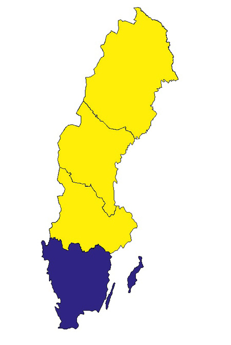
Preparing for a great outdoor adventure? View the Götaland region of Sweden with this highly detailed topographic mapping product. Generated from a resolution of 1:50K and 1:100K over the Swedish part of the Scandinavian mountains, TOPO Sweden provides searchable points of interest and 3-D elevation data on compatible devices.
•Offers regional coverage of Götaland on a DVD and preloaded microSD™/SD™ card
•Integrates topographic data from Lantmäteriet at a scale of 1:50,000 and 1:100,000 to ...
Read more : TOPO Sweden Götaland v3 | Views : 3217 | Replies : 2
Greek Anavasi 5.38
Greek road/topo map with full coverage of Greece routable but without road index, latest version of Anavasi is 5.38.
The Greek cartographic and map creation software
TopoNavigator5 is a cartographic and automated map compotition software for Greece, developed by AnavDigit. Whilst it maintains the functionality of an open GIS environment, TopoNavigator5 tranfers and displays the AnaDigit geodatabase, including full vector topographic and cartographic information, and provides tools for automatic routing, recording, creating and editing ...
Read more : Greek Anavasi 5.38 | Views : 2540 | Replies : 4
Updating Map on Nuvi 780
Hi there,
I have 2 Garmins...a 260W and 780.
I was able to update the 260W using the latest unlocked image (North America 2012.30), however I am not able to do so on the 780...says I don't have enough space - even though I deleted the existing map first.
Is there anything else i can delete to make room without causing a disaster?
I don't have an SD card, but would that be my only ...
Read more : Updating Map on Nuvi 780 | Views : 1607 | Replies : 2
Last 10 active topics
Statistics
Total posts 163857 • Total topics 17331 • Total members 672345


