 Forum
Forumhello
I'm from Brazil
I very much appreciate this forum and always try new it
There latest europe map the City Navigator Europe 2015.20?
I am very grateful to all
(apologies, erroneously posted and do not know how to move)
.

- Contact •
- FAQ •
- Register •
- Login
- View unanswered posts • View active topics
-
 Board index ‹ Site map ‹ News of NaviTotal.com ‹ News of New Maps
It is currently Tue Feb 18, 2025 9:57 pm
 News of New Maps
Site map of New Maps » Forum : New Maps
Bulgaria OFRM Geotrade 2015 Q1
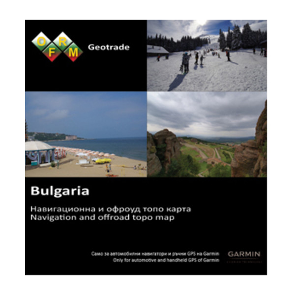
The new version 2015 Q1 is now available for download on our website all customers with an active subscription for updates. As always, we want to express special thanks to all the customers and friends who sent us information found inaccuracies in the previous version, actively helping to refine the map!
Extended coverage in settlements
Enriched information is available for search by address (street and number) with 14 new settlements.
Added new objects ...
Read more : Bulgaria OFRM Geotrade 2015 Q1 | Views : 3918 | Replies : 1
Garmin - City Navigator Australia And New Zealand NT 2015.40
Garmin - City Navigator Australia And New Zealand NT 2015.40
Requirements: compatible device
Overview: Navigate the streets with confidence. This product provides detailed road maps and points of interest for your device, so you can navigate with exact, turn-by-turn directions to any address or intersection.
• Includes nearly 1.3 million km (796,000 mi) of roads, including motorways, national and regional thoroughfares and local roads throughout Australia and New Zealand.
• Displays more than 630,000 points ...
Read more : Garmin - City Navigator Australia And New Zealand NT 2015.40 | Views : 2526 | Replies : 2
BlueChart g2 Vision VAF451S Namibia-Knysna v 16.00

Read more : BlueChart g2 Vision VAF451S Namibia-Knysna v 16.00 | Views : 1510 | Replies : 1
BlueChart g2 Vision - VAF450S - Madeira & Canary Islands 2014.5 (16.00)
BlueChart g2 Vision - VAF450S - Madeira & Canary Islands 2014.5 (16.00)
See your vessel’s precise, on-chart position in relation to navaids, coastal features and restricted areas with premium features found in this detailed marine mapping data. Includes all of the features of our BlueChart® g2 product, plus 3-D perspective above and below the waterline, Auto Guidance, high-resolution imagery, and aerial photos of ports, harbors, marinas and landmarks.
See your vessel’s precise, on-chart position in relation to navaids, coastal features and restricted areas with premium features found in this detailed marine mapping data. Includes all of the features of our BlueChart® g2 product, plus 3-D perspective above and below the waterline, Auto Guidance, high-resolution imagery, and aerial photos of ports, harbors, marinas and landmarks.
- Shaded depth contours, coastlines, spot soundings, ...
Read more : BlueChart g2 Vision - VAF450S - Madeira & Canary Islands 2014.5 (16.00) | Views : 2055 | Replies : 1
TOPO U.S. 100K (v5.01)
TOPO U.S. 100K (v5.01)
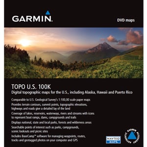
We've mapped every hill and valley for your next great adventure. Now with more detail than ever, this product covers the finer points of the outdoors with topographic maps comparable to 1:100,000 scale USGS maps. It also includes terrain contours, topo elevations, summits, parks, coastlines, rivers, lakes and geographical points.
We've mapped every hill and valley for your next great adventure. Now with more detail than ever, this product covers the finer points of the outdoors with topographic maps comparable to 1:100,000 scale USGS maps. It also includes terrain contours, topo elevations, summits, parks, coastlines, rivers, lakes and geographical points.
- Provides detailed digital topographic maps, comparable to 1:100,000 scale USGS maps.
- Includes updated road content, by NAVTEQ (non-routable). ...
Read more : TOPO U.S. 100K (v5.01) | Views : 5458 | Replies : 9
City Navigator Southeast Asia NT 2014.40
City Navigator Southeast Asia NT 2014.40
Navigate the streets with confidence. This product provides detailed road maps and points of interest for your device, so you can navigate with exact, turn-by-turn directions to any address or intersection.
Navigate the streets with confidence. This product provides detailed road maps and points of interest for your device, so you can navigate with exact, turn-by-turn directions to any address or intersection.
- Displays points of interest, including restaurants, lodging, attractions and shopping.
- Gives turn-by-turn directions on compatible devices.
- Speaks street names (example: "Turn right on Main Street").
- Includes navigational features, such as turn restrictions, roundabout guidance ...
Read more : City Navigator Southeast Asia NT 2014.40 | Views : 16486 | Replies : 12
City Navigator Europe for New Garmin 2599
Is there a City Navigator Europe file somewere not ''NTU'' that I will be to unlock for a newer Garmin nuvi 2599. I understand that the ''NTU'' map cannot be unlocked on the Garmin newer version .
Read more : City Navigator Europe for New Garmin 2599 | Views : 1975 | Replies : 0
Garmin City Navigator Southern Africa NT 2015.40
Garmin City Navigator Southern Africa NT 2015.40
Navigate the streets with confidence. This product provides detailed road maps and points of interest for your device, so you can navigate with exact, turn-by-turn directions to any address or intersection.
Navigate the streets with confidence. This product provides detailed road maps and points of interest for your device, so you can navigate with exact, turn-by-turn directions to any address or intersection.
- Includes more than 1.3 million km (849,000 mi) of roads, including motorways, national and regional thoroughfares and local roads, in South Africa.
- Displays thousands of points of interest throughout the country, including restaurants, petrol/gasoline stations, ...
Read more : Garmin City Navigator Southern Africa NT 2015.40 | Views : 5211 | Replies : 4
BlueChart g2 - HUS027R - Hawaiian Islands-Mariana Islands 2014.5 (16.00)
BlueChart g2 - HUS027R - Hawaiian Islands-Mariana Islands 2014.5 (16.00)
See your vessel’s precise, on-chart position in relation to navaids, coastal features, anchorages, obstructions, waterways, restricted areas and more with this detailed marine mapping data.
See your vessel’s precise, on-chart position in relation to navaids, coastal features, anchorages, obstructions, waterways, restricted areas and more with this detailed marine mapping data.
- Shaded depth contours, coastlines, spot soundings, navaids, port plans, wrecks, obstructions, intertidal zones, restricted areas and IALA symbols.
- Seamless transitions between zoom levels and more continuity across chart boundaries.
- Standard 2-D direct overhead or 3-D “over the ...
Read more : BlueChart g2 - HUS027R - Hawaiian Islands-Mariana Islands 2014.5 (16.00) | Views : 3223 | Replies : 1
Last 10 active topics
Statistics
Total posts 163857 • Total topics 17331 • Total members 672345


