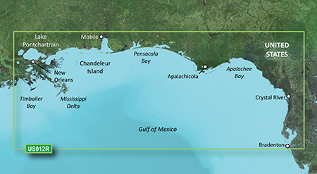
It is currently Tue Feb 18, 2025 11:04 pm

News News of New Maps

Site map of New Maps » Forum : New Maps

BlueChart g2 Vision VUS012R - Tampa-New Orleans v 15.50

Image

unl.img
PID 1, FID 3244, region 1,23


This board requires you to be registered and logged-in to view hidden content.
Read more : BlueChart g2 Vision VUS012R - Tampa-New Orleans v 15.50 | Views : 2704 | Replies : 2


Bluechart G2 Vision VUS003R - Cape Cod V 15.50

Image

PID 1, FID 3244, region 1,14
unl.img

This board requires you to be registered and logged-in to view hidden content.
Read more : Bluechart G2 Vision VUS003R - Cape Cod V 15.50 | Views : 2884 | Replies : 1


BlueChart g2 Vision - VEU050R - Gulfs of Finland & Riga 2014.0 (15.50)

BlueChart g2 Vision - VEU050R - Gulfs of Finland & Riga 2014.0 (15.50)
(VEU050R - Aland-Vyborg)

See your vessel’s precise, on-chart position in relation to navaids, coastal features and restricted areas with premium features found in this detailed marine mapping data. Includes all of the features of our BlueChart® g2 product, plus 3-D perspective above and below the waterline, Auto Guidance, high-resolution imagery, and aerial photos of ports, harbors, marinas and landmarks.
  • Shaded depth ...


BlueChart g2 Vision - VEU047R - Gulf of Bothnia-Kalix-Grisslehamn 2014.0 (15.50)

BlueChart g2 Vision - VEU047R - Gulf of Bothnia-Kalix-Grisslehamn 2014.0 (15.50)

See your vessel’s precise, on-chart position in relation to navaids, coastal features and restricted areas with premium features found in this detailed marine mapping data. Includes all of the features of our BlueChart® g2 product, plus 3-D perspective above and below the waterline, Auto Guidance, high-resolution imagery, and aerial photos of ports, harbors, marinas and landmarks.
  • Shaded depth contours, coastlines, spot soundings, navaids, ...


HUS999I - US Marine Detail Map g2 Update Card v2014.00 (v15.50)

HUS999I - US Marine Detail Map g2 Update Card v2014.00 (v15.50)
Part Number: 010-10800-72 (MicroSD/SD), 010-D0616-00 (Download)

This preprogrammed update card for your chartplotter gives you detailed electronic nautical charts that provide a smooth data transition between zoom levels. Data includes navaids, port plans, depth contours, fishing contours, spot soundings and more. Sharp, colorful graphics let you see every cartographic contour and feature, with a minimum of panning and zooming to bring the chart data ...
Read more : HUS999I - US Marine Detail Map g2 Update Card v2014.00 (v15.50) | Views : 2682 | Replies : 1


BlueChart g2 - HSA001R - South America East Coast 2014.0 (15.50)

BlueChart g2 - HSA001R - South America East Coast 2014.0 (15.50)

See your vessel’s precise, on-chart position in relation to navaids, coastal features, anchorages, obstructions, waterways, restricted areas and more with this detailed marine mapping data.
  • Shaded depth contours, coastlines, spot soundings, navaids, port plans, wrecks, obstructions, intertidal zones, restricted areas and IALA symbols.
  • Seamless transitions between zoom levels and more continuity across chart boundaries.
  • Standard 2-D direct overhead or 3-D “over ...
Read more : BlueChart g2 - HSA001R - South America East Coast 2014.0 (15.50) | Views : 4121 | Replies : 5


BlueChart g2 Vision - VUS032R - Southern Gulf of Mexico 2014.0 (15.50)

BlueChart g2 Vision - VUS032R - Southern Gulf of Mexico 2014.0 (15.50)

See your vessel’s precise, on-chart position in relation to navaids, coastal features and restricted areas with premium features found in this detailed marine mapping data. Includes all of the features of our BlueChart® g2 product, plus 3-D perspective above and below the waterline, Auto Guidance, high-resolution imagery, and aerial photos of ports, harbors, marinas and landmarks.
  • Shaded depth contours, coastlines, spot soundings, ...


BlueChart g2 - HEU050R - Gulfs of Finland & Riga 2014.0 (15.50)

BlueChart g2 - HEU050R - Gulfs of Finland & Riga 2014.0 (15.50)

See your vessel’s precise, on-chart position in relation to navaids, coastal features, anchorages, obstructions, waterways, restricted areas and more with this detailed marine mapping data.
  • Shaded depth contours, coastlines, spot soundings, navaids, port plans, wrecks, obstructions, intertidal zones, restricted areas and IALA symbols.
  • Seamless transitions between zoom levels and more continuity across chart boundaries.
  • Standard 2-D direct overhead or 3-D ...
Read more : BlueChart g2 - HEU050R - Gulfs of Finland & Riga 2014.0 (15.50) | Views : 2408 | Replies : 1


Region East TOPO NT 1.9

Regio Eesti TOPO NT 1.9

FID: 1310

Download
Locked Image: Download

UnLocked Image: Download
Read more : Region East TOPO NT 1.9 | Views : 2046 | Replies : 1


Region East teed NT 1.15

Regio Eesti teed NT 1.15

FID: 846

Download:
Locked Image: Download

UnLocked Image: Download
Read more : Region East teed NT 1.15 | Views : 1863 | Replies : 0


Login  •  Register


Statistics

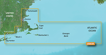
Total posts 163857 • Total topics 17331 • Total members 672345