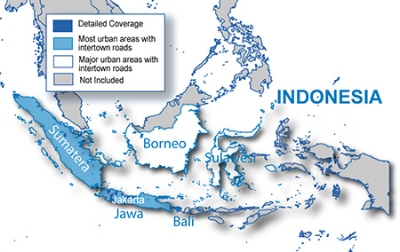
It is currently Tue Feb 18, 2025 9:57 pm

News News of New Maps

Site map of New Maps » Forum : New Maps


City Navigator Europe NT (Unicode) 2015.10

City Navigator Europe NT (Unicode) 2015.10

FID 3339

MapSource: 6 parts Locked


MapSource: 6 parts UnLocked


Image: 7 parts Locked


Image: 7 parts UnLocked


3D
Read more : City Navigator Europe NT (Unicode) 2015.10 | Views : 13040 | Replies : 27


TOPO Drive Hellas 2014.A

TOPO Drive Hellas 2014.A
New version of the map released May 14. 2014 by Geodata. With this version (2014.A) DEM is available again.

Image: (Greek characters NT) FID: 4928
Locked: Download

UnLocked: Download


Image: (Latin characters NT) FID: 4929
Locked: Download

UnLocked: Download


Google Translate:
The Map
The Topodrive Hellas created to meet the needs of navigation and off-road. There is a simple roadmap but not only topographic map. Is the map that will lead you ...
Read more : TOPO Drive Hellas 2014.A | Views : 1978 | Replies : 1


City Navigator India NT 2014.20 HERE

City Navigator India NT 2014.20 HERE

FID: 3375

Image:
Locked: Part1 | Part2

UnLocked: Part1 | Part2


JCV, SID & Sqlite:


Code: Select all
https://buy.garmin.com/en-GB/GB/prod65217.html#coverageTab
Read more : City Navigator India NT 2014.20 HERE | Views : 3331 | Replies : 4


City Navigator Thailand NT 2014.10

City Navigator Thailand NT 2014.10

Streets change and businesses open and close. Get the most up-to-date map data on your device with this single map update.

  • Updated detailed street maps.
  • Updated points of interest, such as gas stations, parking garages, restaurants, hotels and ATM locations.
  • Faster, more accurate routing when you drive with the latest map information.
Coverage
Features updated, fully-routable maps for Thailand, including detailed coverage for the municipalities of Chiang ...
Read more : City Navigator Thailand NT 2014.10 | Views : 3298 | Replies : 2


BlueChart g2 - HEU047R - Gulf of Bothnia-Kalix-Grisslehamn 2014.0 (15.50)

BlueChart g2 - HEU047R - Gulf of Bothnia-Kalix-Grisslehamn 2014.0 (15.50)

See your vessel’s precise, on-chart position in relation to navaids, coastal features, anchorages, obstructions, waterways, restricted areas and more with this detailed marine mapping data.
  • Shaded depth contours, coastlines, spot soundings, navaids, port plans, wrecks, obstructions, intertidal zones, restricted areas and IALA symbols.
  • Seamless transitions between zoom levels and more continuity across chart boundaries.
  • Standard 2-D direct overhead or 3-D “over the ...


City Navigator North America NT 2015.10

City Navigator North America NT 2015.10

Navigate the streets with confidence. This product provides detailed road maps and points of interest for your device, so you can navigate with exact, turn-by-turn directions to any address or intersection.

  • Displays millions of points of interest, including hotels, restaurants, parking, entertainment, fuel and shopping.
  • Includes postal code support for Canada.
  • Gives turn-by-turn directions on compatible devices.
  • Speaks street names (example: "Turn right on Main ...
Read more : City Navigator North America NT 2015.10 | Views : 8010 | Replies : 15


BlueChart g2 - HEU505S - Baltic Sea, East Coast 2014.0 (15.50)

BlueChart g2 - HEU505S - Baltic Sea, East Coast 2014.0 (15.50)

See your vessel’s precise, on-chart position in relation to navaids, coastal features, anchorages, obstructions, waterways, restricted areas and more with this detailed marine mapping data.
  • Shaded depth contours, coastlines, spot soundings, navaids, port plans, wrecks, obstructions, intertidal zones, restricted areas and IALA symbols.
  • Seamless transitions between zoom levels and more continuity across chart boundaries.
  • Standard 2-D direct overhead or 3-D “over ...
Read more : BlueChart g2 - HEU505S - Baltic Sea, East Coast 2014.0 (15.50) | Views : 3554 | Replies : 2


BlueChart g2 - HEU452S - Adriatic Sea, North Coast 2014.0 (15.50)

BlueChart g2 - HEU452S - Adriatic Sea, North Coast 2014.0 (15.50)

See your vessel’s precise, on-chart position in relation to navaids, coastal features, anchorages, obstructions, waterways, restricted areas and more with this detailed marine mapping data.
  • Shaded depth contours, coastlines, spot soundings, navaids, port plans, wrecks, obstructions, intertidal zones, restricted areas and IALA symbols.
  • Seamless transitions between zoom levels and more continuity across chart boundaries.
  • Standard 2-D direct overhead or 3-D “over ...


Bluechart g2 - HSA001R - South America East 2013.0 (14.50)

Bluechart g2 - HSA001R - South America East 2013.0 (14.50)

See your vessel’s precise, on-chart position in relation to navaids, coastal features, anchorages, obstructions, waterways, restricted areas and more with this detailed marine mapping data.

  • Shaded depth contours, coastlines, spot soundings, navaids, port plans, wrecks, obstructions, intertidal zones, restricted areas and IALA symbols.
  • Seamless transitions between zoom levels and more continuity across chart boundaries.
  • Standard 2-D direct overhead or 3-D “over the ...
Read more : Bluechart g2 - HSA001R - South America East 2013.0 (14.50) | Views : 2030 | Replies : 2


Login  •  Register


Statistics

Total posts 163857 • Total topics 17331 • Total members 672345