It is currently Mon Nov 25, 2024 5:26 am

News News of New Maps

Site map of New Maps » Forum : New Maps

Bluechart g2 HXEU302P Lake Balaton v.15

Bluechart g2 HXEU302P Lake Balaton 2013.5 v.15

Image

unl.img

HXEU302P v15.rar
http://www.share-byte.net/7Jr38F

thanks to guy who share this map
Read more : Bluechart g2 HXEU302P Lake Balaton v.15 | Views : 1822 | Replies : 1


Buechart G2 HXAF451S Namibia-Knysna, SA v.15

Buechart G2 HXAF451S Namibia-Knysna, SA 2013.5 v.15

Image


unl.img

HXAF451S v15.00.rar
http://www.share-byte.net/EJ4vJQ
Read more : Buechart G2 HXAF451S Namibia-Knysna, SA v.15 | Views : 1335 | Replies : 0


Bluechart g2 Vision VCA012R Lake of the Woods-Rainy Lake V.1

Bluechart g2 Vision VCA012R Lake of the Woods-Rainy Lake v2013.5 V.15.00

Image


unl.img

VCA012R v15.rar
http://www.share-byte.net/v3xy6g
Read more : Bluechart g2 Vision VCA012R Lake of the Woods-Rainy Lake V.1 | Views : 1733 | Replies : 0


Bulgaria OFRM Geotrade 2013 Q4

Image

The new version Q4 2013 is now available for download from our website for all users with an active subscription to updates. As always we want to express special thanks to all the customers and friends who sent us information found inaccuracies in the previous version , actively helping to refine the map!


Updates urban and national road network


In version 2013 Q4 newly added circular motion in Blagoevgrad and Sliven flyover in Parvomai ...
Read more : Bulgaria OFRM Geotrade 2013 Q4 | Views : 2037 | Replies : 2


Garmap Sub-Saharan Africa Streetmaps 2013.2 - NT Only (Final

Garmap Sub-Saharan Africa Streetmaps 2013 - NT Only (Final Edition)


Image
Product description:
This edition provides a new version of the popular Garmap Sub-Saharan Africa Streetmaps as the data set has been revised and updated. Coverage for the map set is 29 countries, over 1.38 million kilometres of routable roads, a massive 3 million kilometres of non-routable coverage and over 570 000 Points of Interest (POIs). POI coverage increased in Ghana (33%) and Uganda ...
Read more : Garmap Sub-Saharan Africa Streetmaps 2013.2 - NT Only (Final | Views : 2857 | Replies : 2


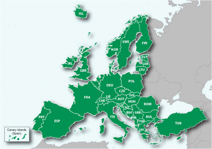
Garmin Europe Recreation Map

Image

Details correspond to a 1:100.000 scale recreational paper map. Available for 48 countries across Western and Eastern Europe. Coverage detail varies depending on country. This map does not include any routing data and is unable to provide turn-by turn road navigation directions.

Recreation Map of Europe v.4
unl.img
This board requires you to be registered and logged-in to view hidden content.


thanks to guy who share this map
Read more : Garmin Europe Recreation Map | Views : 5617 | Replies : 4


Login  •  Register


Statistics

Total posts 163120 • Total topics 17273 • Total members 666538